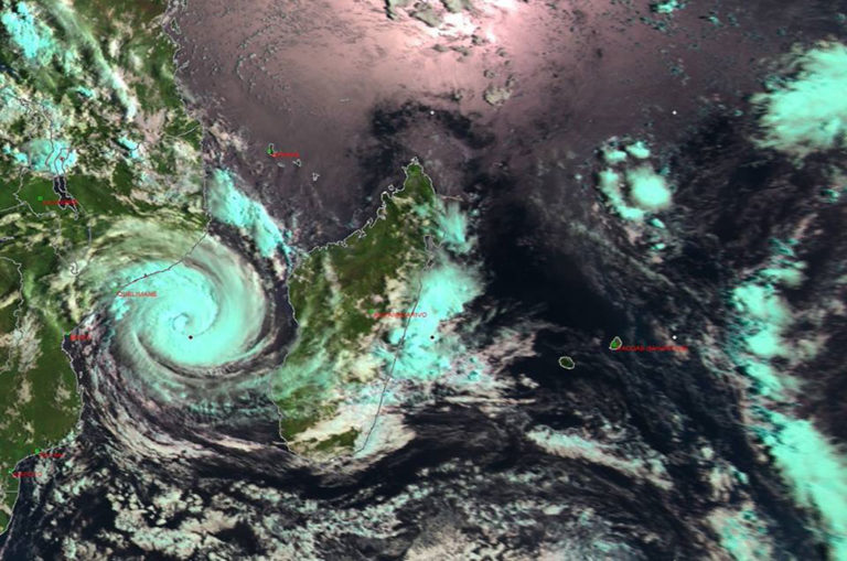
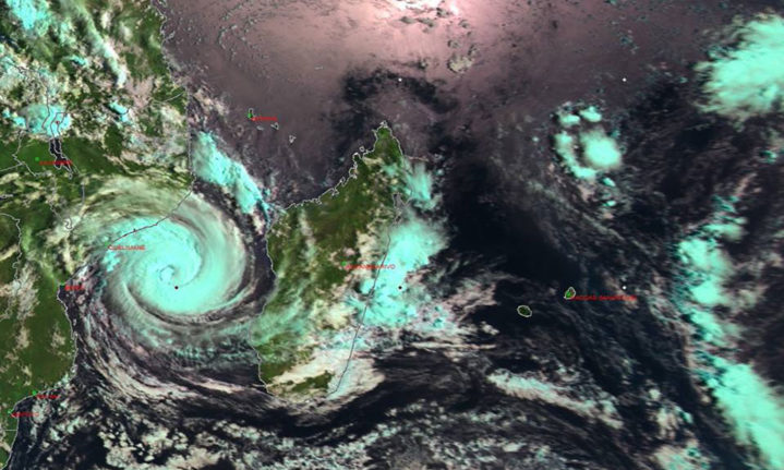
A tropical cyclone is expected to arrive on the shores of Mozambique tomorrow evening, but seems to pose little threat to South Africa at the moment, according to South African Weather Services.
Also known as hurricanes or typhoons depending on which oceans they form over, cyclones are storms that form over warm tropical oceans and bring high winds and rainfall to affected locations.
It is not known exactly when and where this tropical cyclone, which has been named Idai, will make landfall, but it is expected to touch down near the port city of Beira on the coast of Mozambique on Thursday evening.
https://www.instagram.com/p/Bu6ntCVHaml/
According to the South African Weather Services, Idai is currently over the northern parts of the Mozambique channel between Mozambique and Madagascar.
Although it hasn’t yet hit Mozambique, the tropical storm has already caused flooding which has claimed 66 lives and affected 140,000 people in the country.
At the moment, the average windspeed of the cyclone is 140km per hour, and is expected to remain strong. The cyclone may produce gusts of up to 220km per hour.

A satellite image of tropical cyclone Idai on the morning or 13 March 2019. Image: SA Weather Services.
The South African Weather Services predict there will be torrential rain of 250mm to 350mm in a 24-hour period. This will create widespread flooding in central Mozambique.
It is predicted that Idai will move in a south-westerly direction over the next few days.
By Friday, the storm is expected to have weakened as it moves away from the sea and reaches eastern parts of Zimbabwe and southern parts of Malawi. These countries will also be at risk of torrential rain and flooding.
To keep updated on how the cyclone may effect South Africa, refer to the South African Weather Services’ Weather Warning map.
Feature Image: Pixabay.


