


Let’s take a walk down memory lane with these images of what Cape Town used to look like, with most of the images dating back as far as the early 1900s.
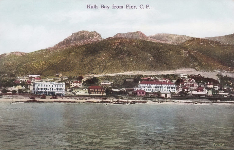
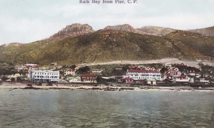
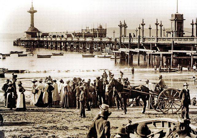
Kalk Bay from the pier – early 1900s. Picture: Martin Greshoff’s postcard collection

Seapoint Pavilion – 1970s. Picture: Martin Greshoff’s postcard collection
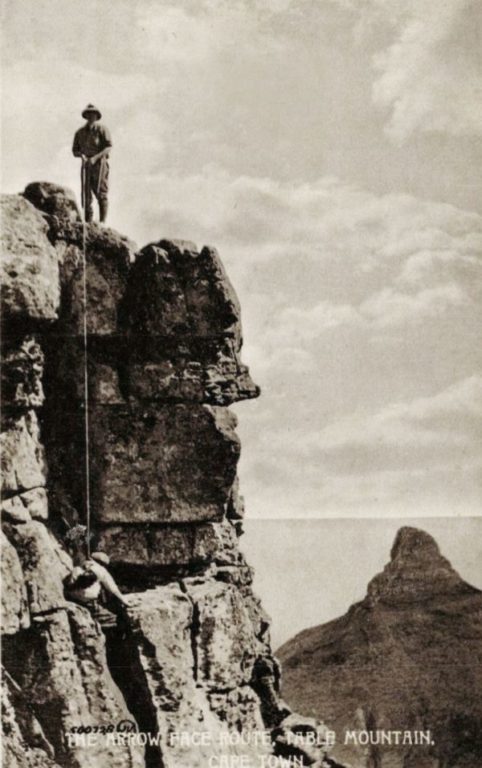
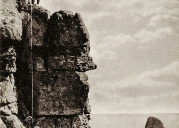
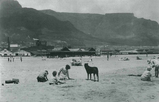
Arrow Face, Table Mountain – undated. Picture: Martin Greshoff’s postcard collection
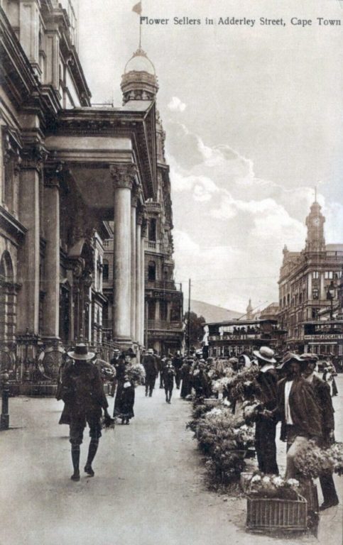
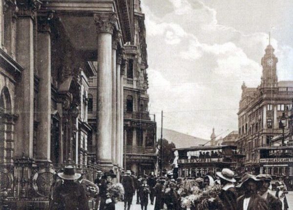
Flower Sellers in Adderley Street – undated. Picture: Martin Greshoff’s postcard collection
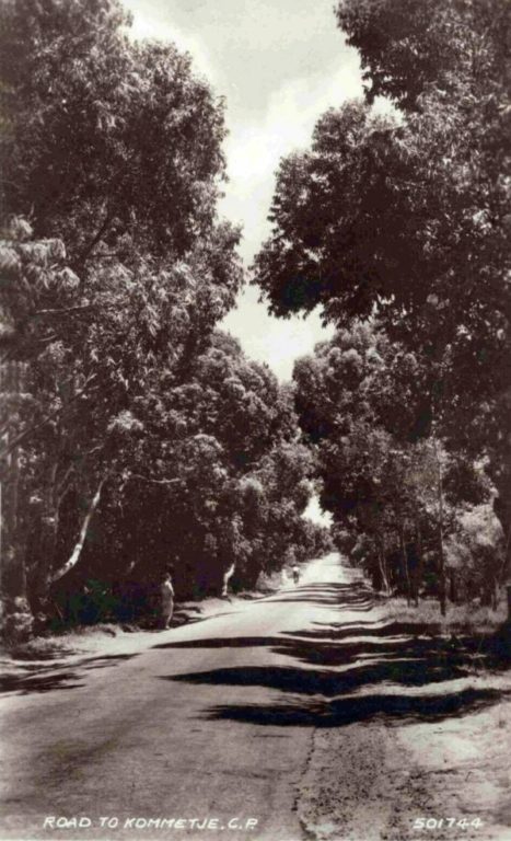
Road to Kommetjie – 1959. Picture: Martin Greshoff’s postcard collection
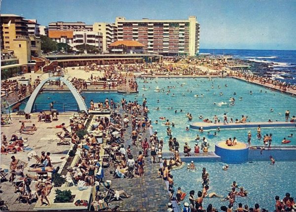
Seapoint Pavillion – 1970s. Picture: Martin Greshoff’s postcard collection
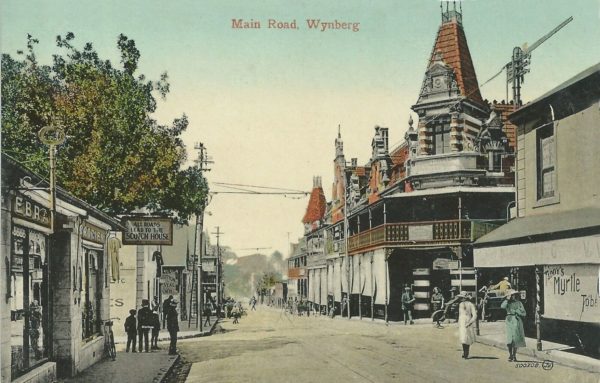
Wynberg Main Road – 1900s. Picture: Martin Greshoff’s postcard collection
Picture: Woodstock Improvement District
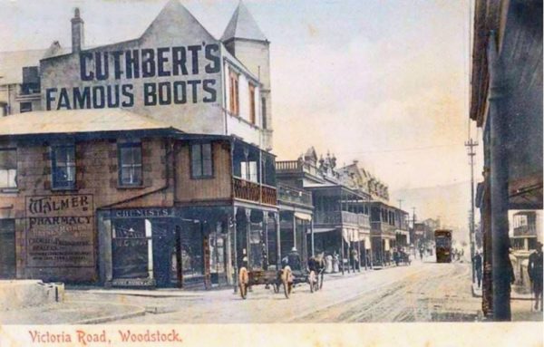
Victoria Road, Woodstock – 1900s. Picture: Martin Greshoff’s postcard collection

Picture: Martin Greshoff’s postcard collection

Kloof Road – 1906. Picture: Martin Greshoff’s postcard collection
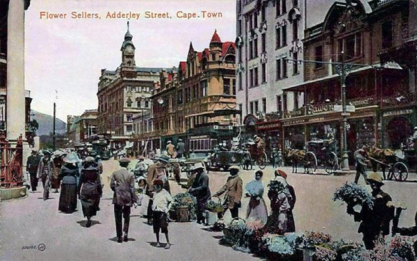
Flower Sellers in Adderley Street – 1900s. Picture: Martin Greshoff’s postcard collection.
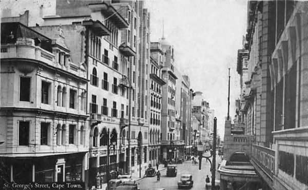
St. George’s Street, Cape Town – undated. Picture: Martin Greshoff’s postcard collection

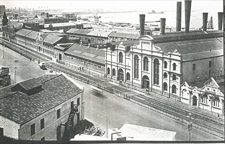
Victoria Basin – undated. Picture: Martin Greshoff’s postcard collection
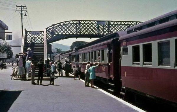
Worcester or Touws River prior to installation of electrical overhead power cables – undated. Picture: Elma Ross
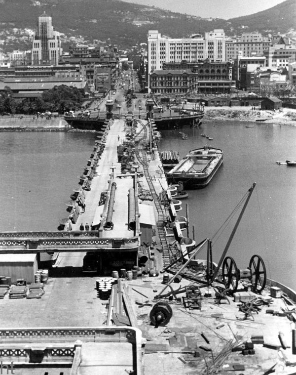
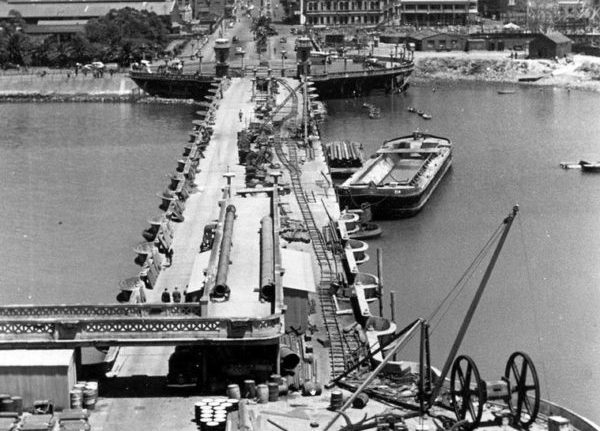
Demolition of the Cape Town Pier – undated. Picture: Hilton Teper Collection
Gathering of people at Roggebaai during the early 1900s. Picture: Hilton Teper collection

Advert for 1934 Ford V-8 De Lux. Picture: Etienne Du Plessis collection
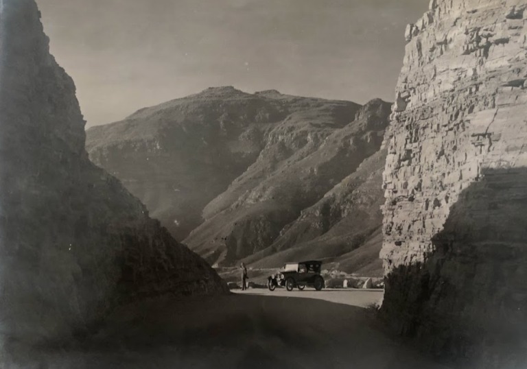
Rest stop Chapman’s Drive. Circa 1920s.

Princess Elizabeth and Princess Margaret in the cab of a South African Railways GMAM Garratt steam locomotive during the Royal tour of 1947.
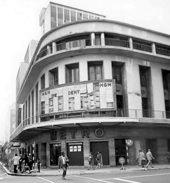
The Metro Theatre was built along St. George’s Street. Circa 1930s. Demolished during 1970’s. Picture: South Africa Cinema Treasures
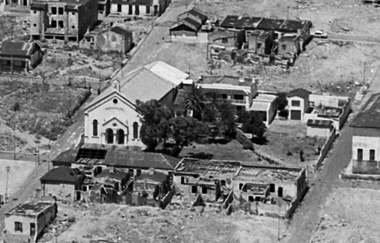
The Moravian Hill Chapel (left) and Moravian Hill homestead/parsonage (centre) during the demolitions of District Six. All the buildings on the surrounding streets were demolished, leaving the Moravian Hill block standing isolated. Picture: City of Cape Town Heritage Office
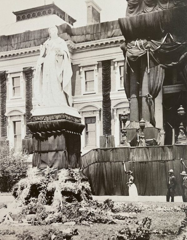
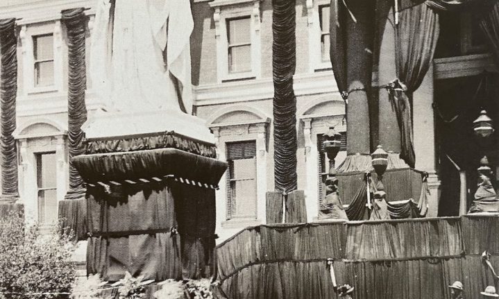
Queen Victoria’s statue and the Houses of Parliament in Cape Town draped in mourning cloth after the death of Queen Victoria on 22 January 1901.
Route through town of the Sea Point light railway. Suspected Dock road near the old power station.
Pictures: UCT Library Digital Collection
ALSO READ: Remembering the Laingsburg flood